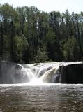
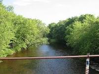
Pigeon river
The Pigeon River forms part of the Canada/United States border between the state of Minnesota and the province of Ontario, west of Lake Superior. In pre-industrial times the river was a waterway of great importance for transportation and trade.
The Pigeon River forms part of the Canada/United States border between the state of Minnesota and the province of Ontario, west of Lake Superior. In pre-industrial times the river was a waterway of great importance for transportation and trade.

Cannon River
The Cannon River flows 112 miles from Shields Lake near Faribault, Minnesota to Red Wing in the U.S. state of Minnesota, where it joins the Mississippi River. It drains a watershed approximately 1460 square miles in size.
The Cannon River flows 112 miles from Shields Lake near Faribault, Minnesota to Red Wing in the U.S. state of Minnesota, where it joins the Mississippi River. It drains a watershed approximately 1460 square miles in size.
Zumbro river
The Zumbro River is a tributary of the Mississippi River in the Driftless Area of southeastern Minnesota in the United States. It is 64.6 miles long from the confluence of its principal tributaries and drains a watershed of 1,428 square miles.
The Zumbro River is a tributary of the Mississippi River in the Driftless Area of southeastern Minnesota in the United States. It is 64.6 miles long from the confluence of its principal tributaries and drains a watershed of 1,428 square miles.

Otter Tail river
The Otter Tail River is a 192-mile-long river in the west-central portion of the U.S. state of Minnesota. It begins in Clearwater County, 40 miles southwest of Bemidji.
The Otter Tail River is a 192-mile-long river in the west-central portion of the U.S. state of Minnesota. It begins in Clearwater County, 40 miles southwest of Bemidji.
Vermillion river
The Vermillion River is a 59.6-mile waterway that meanders through Scott County and Dakota County in Minnesota, entering the Mississippi River floodplain just south of Hastings.
The Vermillion River is a 59.6-mile waterway that meanders through Scott County and Dakota County in Minnesota, entering the Mississippi River floodplain just south of Hastings.
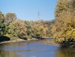
Minnesota River
The Minnesota River is a tributary of the Mississippi River, approximately 332 miles long, in the U.S. state of Minnesota.
The Minnesota River is a tributary of the Mississippi River, approximately 332 miles long, in the U.S. state of Minnesota.

Rainy River
The Rainy River is a river, approximately 137 kilometres long, which forms part of the U.S.-Canada border separating northern Minnesota and Northwestern Ontario.
The Rainy River is a river, approximately 137 kilometres long, which forms part of the U.S.-Canada border separating northern Minnesota and Northwestern Ontario.
Rum River
The Rum River is a slow, meandering channel that connects Minnesota's Mille Lacs Lake with the Mississippi River.
The Rum River is a slow, meandering channel that connects Minnesota's Mille Lacs Lake with the Mississippi River.
